Kadıköy is one of the fastest growing districts in Istanbul for the last 25 years. The basic strategy of the upper-scale approach to the project is to provide integrity between the dense urban texture and the sea in the east of the competition area;
Project team
Hakan Okan ÇETİN, Architect (Team Leader)
Ali SİNAN, Architect
Nebahat Nihan PARLAK, Landscape Architect
Mert AKAY, Şehir Plancısı, Urban Designer
Ecem KUTLAY, Urban Planner, Urban Designer
Seçkin ÇİRİŞ, Urban Planner, Transport Engineer
Advisor
Olgu ÇALIŞKAN, Urban Planner, Urban Designer
Helpers
Halil Baha AKYAR, Architect
Ayşe Selcan ŞİMŞEK, Student
Gülnur AKTAŞ, Student
Elif Naz DUMAN, Student
It is to provide strengthened connectivity in the north-south axis extending from Karacaahmet Cemetery to Moda Beach. The strategy of redefining the area with suggestion axes and ensuring its accessibility at urban scale in a controlled manner expressed the priority design approach that also determines the conceptual framework of the project: Loop.
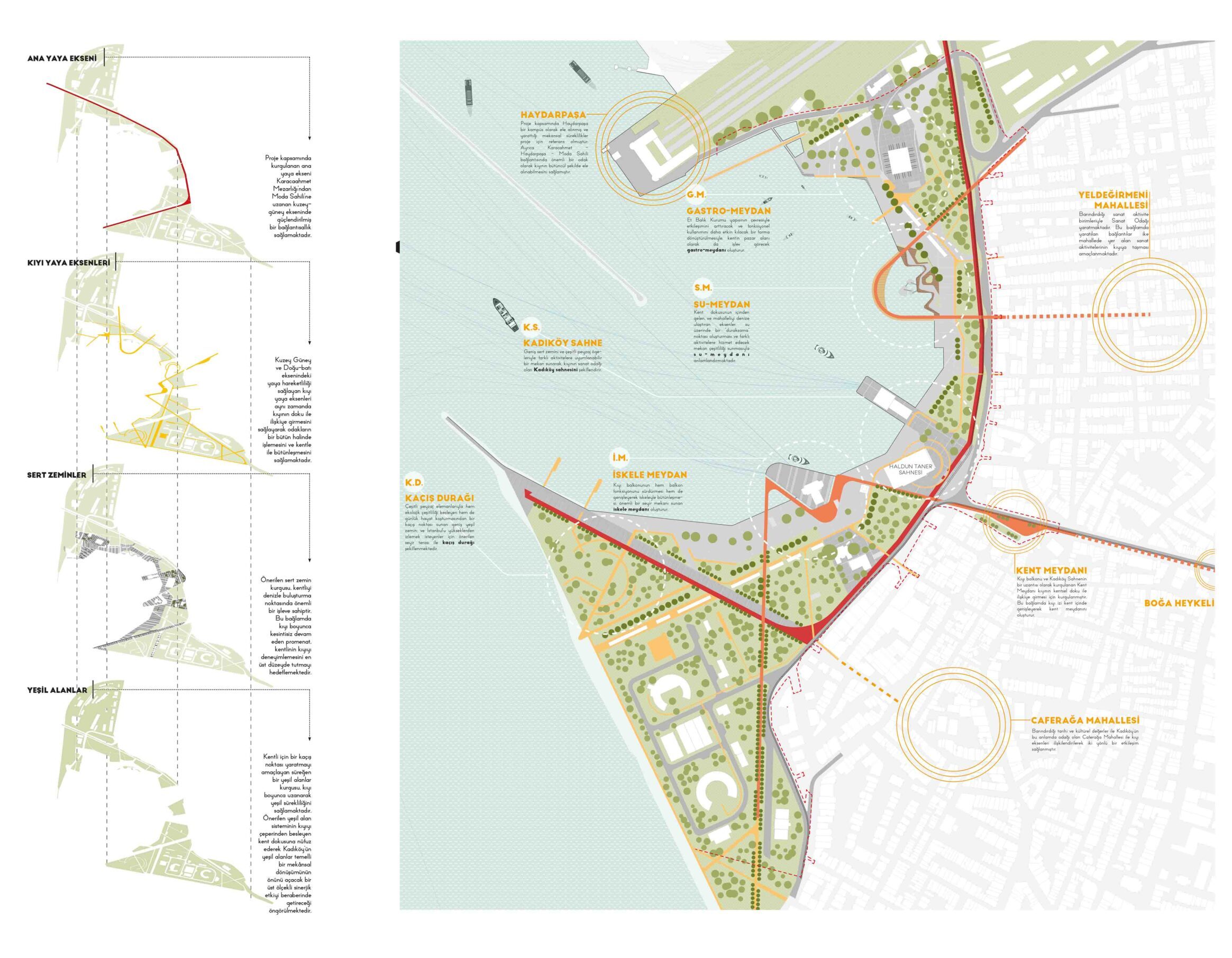
Although Kadıköy’s current transfer center role is one of the prominent features of the area in terms of accessibility: especially the area where IETT buses are located on the beach, damages the continuity between the coast and the city on the east-west axis, while seriously reducing the surface area of the coast that can be actively experienced. In this framework, a series of regulations is envisaged that will be accepted as the current public transport transfer point function of the Kadıköy coast and will support this spatial operation in the direction of urban space production.
Green areas open to public use are of great importance in ensuring the integration of the focuses with each other in the competition area. The green pattern, which starts from Karaca Ahmet Cemetery on the north-south axis and includes the university campus, is aimed to gain a public and recreational function by being included in the competition with the structure of the Meat Fish Institution.
The green pattern, which has gained continuity along the coastline, was expanded volumetrically by the closure of the area close to the sea of Rıhtım Sokak to vehicle traffic and its connection with the pedestrian axis reaching the beach from Caferağa.

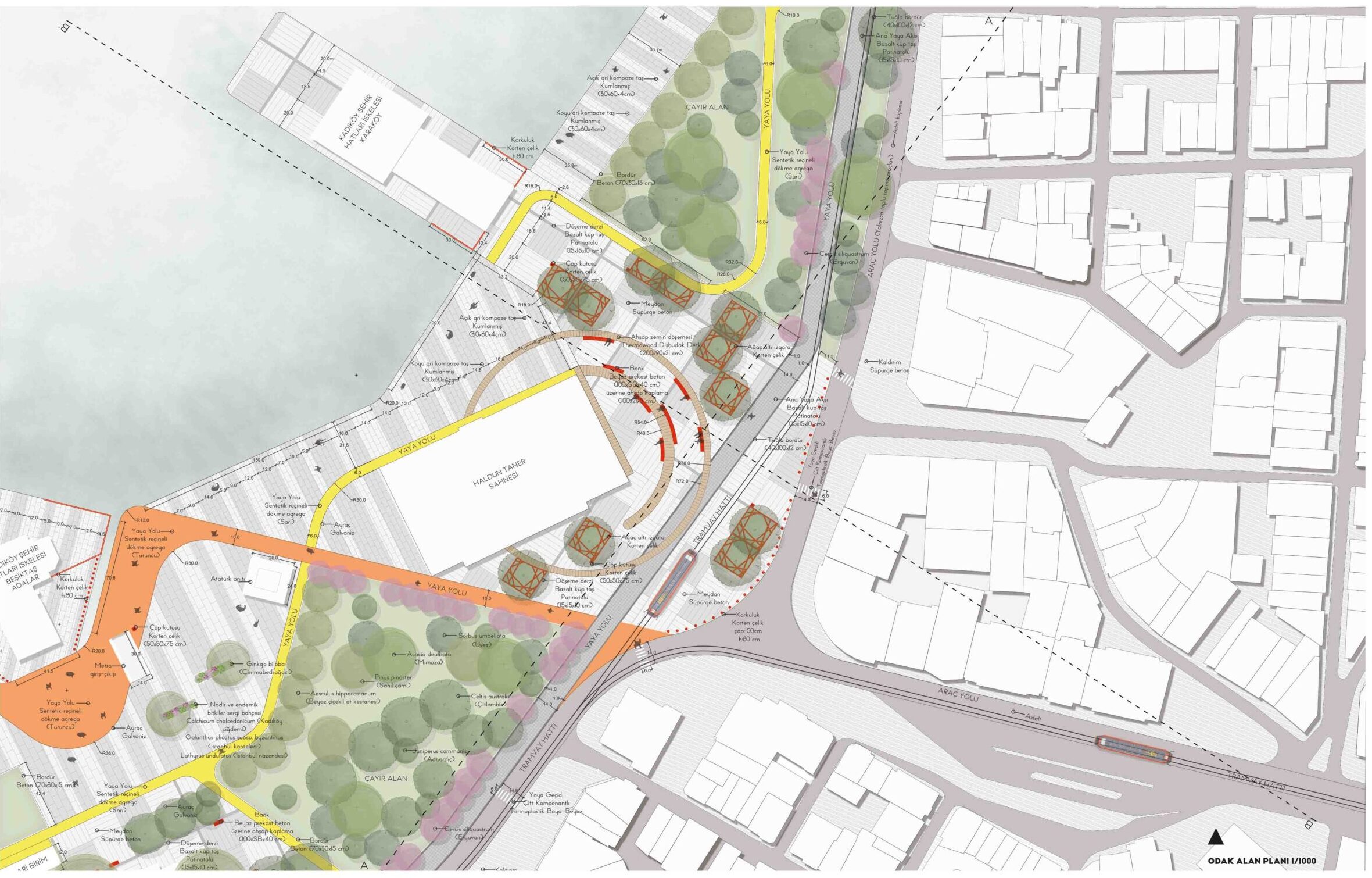
Throughout the competition process, helped with green area, pedestrians, and public transit analysis. In the final state, contributed to the project team with visualization of 1:500 detailed plan and sections